Services
REFORESTATION THROUGH DRONE TECHNOLOGY, ARTIFICIAL AND DATA DRIVEN INTELLIGENCE
Aerial Seeding & Tree Planting
Planting with drones is a low cost, low-impact solution to reforesting native species and provide several supplementary nutrients, minerals and other additions, all of which are necessary for developing seedlings but may not be available in abundance in the soil at a planting location.
These unique advantages boost the growth rates of developing seedlings by delivering necessary elements directly to the root systems of the germinated seeds.
More Details

Reforestation Process
01
Mapping, Surveying and Ground Truth Analysis
Terrain mapping, soil analysis and ecosystem modelling occurs to identify beneficial species and respective seed pod bio-tech design.
02
Seed Balls and Ground Preparation
A soil and species specific, nutrient rich seed pod is manufactured onsite using our proprietary seed pod mobile manufacturing plant.
03
Planning Flights and Deploying Drones
Drones fly autonomously, planting up to 2 carbon seed pods per second whilst logging the GPS location of every seed pod planted.
04
Post Planting Monitoring and Surveying
Re-map planted areas 1–6 months later to monitor seedling growth and implement proactive protection measures if required.
Nature Based Projects Turn-Key Solutions
Offset your carbon
All our projects are verified so you can achieve certified emissions reduction. We provide high-integrity carbon credits and data driven reporting
Landowners NbS projects
If you are a landowner looking to contribute to the regeneration of the Natural world and sell high-integrity carbon credits
Monitor, survey and report
We can identify and quantify native and invasive species and provide a detailed ecosystem assessment
NbS project development
Using our drone technology we reduce your costs and accelerate Afforestation and Reforestation interventions
Software platform
Integrates data collection, AI processing and data driven insights. Full ecosystem overview and automated reporting
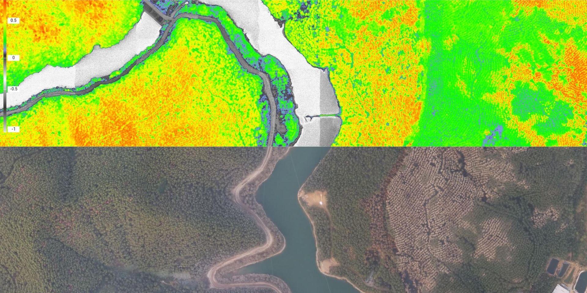
MONITOR, SURVEY AND REPORT
Ecosystem Data Driven Insights For Targeted Interventions
from erosion risk, vegetation health per species, quantification of native and invasive flora, in days.
Monitor & Survey
Our Aerial Survey can capture data with ultra
high resolution quality, allowing us to visualise entire ecosystems from
individual leaves on trees and blades of grass to every animal roaming the land.
With AI technology, we can analyse and provide insights
covering erosion risk, vegetation health per species,
quantification of native and invasive flora in days.
Natural Resource Management
Drones enable large-scale, detailed surveys of natural resources, providing accurate maps and models as well as telemetry data.

Deploy drones with high-resolution and multispectral sensors to map forests, sample vegetation, or monitor and manage the health of forests and wildlife. Trained by our Nature team our machine learning platform delivers greater level accuracy and faster insights than traditional methods.
-
Species Identification
Native and invasive species
-
Species Quantification
Complete counts of every tree, shrub and grass on your site
-
Ecosystem Assessment
Full ecosystem assessment of biodiversity, plant growth, soil condition and carbon
-
Reporting
Enable full site reporting consistent with regulatory requirements

Help us protect and preserve for future generations
Join us and make the planet a better place.